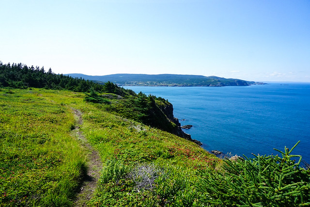
I’ve decided to branch out a bit with a new series about hiking the East Coast Trail. I’ve done a ton of hiking (and blog posts) about my adventures in BC and my travels abroad, but I haven’t taken the time to write about one of my all time favourite trails. I grew up in St. John’s, Newfoundland and have spent lots of time hiking this unique trail over the past 10 years or so. I figured it was time to share it with the rest of you!
The East Coast Trail is approximately 300km of trail that runs down the entire coast of Newfoundland’s Avalon Peninsula. It’s hard to determine the exact length of the trail because it stops in many communities as you travel down the coast and can be completed either as a thru-hike, or much more popularly, as section hikes. According to the East Coast Trail Association, which maintains and manages the trails, the trail is comprised of 25 paths that connect more than 30 coastal communities. It you opt to do the trail as a thru-hike it would be more than 300km with all the road walking between communities. The longest section of trail is 23km, so most Newfoundlanders opt to do the trail as a series of section hikes, either with 2 vehicles or as a round trip. You are permitted to camp anywhere along the trail, but there are 5 official campsites along the larger sections of trail if you want to do some sections as an overnight.
The trail is entirely coastal, though of course it does go through large sections of wooded areas where the coast is not directly accessible. While it’s not mountainous, it is still a very strenuous trail as it will take you up and down through many beaches, coves, and headlands over the length of the trail. Some trails are more well maintained than others, making for some pretty technical hikes along some of the longer and less travelled paths. But the trail passes through some of the most beautiful coastline and rural communities and I love hiking there on a sunny day, with the wind blowing at my back, eating copious amounts of fresh berries and watching the whales fish along the cliffs.
I’ve slowly been working on tackling this trail over the past 10 years and currently I am about 60% complete. However, the ECT association is always working on continuing to expand the trail and have added 4 trails down the northwest side of the peninsula over the past few years, so the trail is always growing! There’s some variation in paths and I have 28 to complete on my list. My plan is to list all the trails here and then work on individual blog posts for the sections I’ve completed and link them back here as I go.
| Trail | From | To | Distance | Time | Rating |
| Long Shore Path | Topsail | Portugal Cove | 17.2km | 6-8 hours | Strenuous |
| Piccos Ridge Path | Portugal Cove | Bauline | 14.5km | 7-9 hours | Strenuous |
| White Horse Path | Bauline | Cape St. Francis | 18.2km | 8-10 hours | Strenuous |
| Biscan Cove Path | Cape St. Francis | Pouch Cove | 7km | 2-4 hours | Moderate |
| Stiles Cove Path | Pouch Cove | Flatrock | 15.1km | 5-7 hours | Difficult |
| Father Troy’s Trail | Flatrock | Torbay | 8.9km | 2-4 hours | Moderate |
| Silver Mine Head Path | Torbay | Middle Cove | 1.9km | 1-2 hours | Easy |
| Cobblers Path | Outer Cove | Logy Bay | 5km | 2-3 hours | Moderate |
| Sugarloaf Path | Logy Bay | Quidi Vidi | 8.8km | 3-5 hours | Difficult |
| Signal Hill Trail** | Quidi Vidi | The Battery | 3km | 1-2 hours | Moderate |
| Deadmans Bay Path | Fort Amherst | Blackhead | 10.5km | 4-7 hours | Difficult |
| Blackhead Path | Blackhead | Cape Spear | 4.4km | 1-2 hours | Moderate |
| Cape Spear Path | Cape Spear | Maddox Cove | 11km | 4-6 hours | Moderate |
| Motion Path* | Petty Harbour | Shoal Bay Road | 20.1km | 5-8 hours | Difficult |
| Spout Path* | Shoal Bay Road | Bay Bulls | 22.5km | 7-9 hours | Strenuous |
| Mickeleens Path | Bay Bulls | Witless Bay | 7.2km | 2-4 hours | Moderate |
| Beaches Path | Witless Bay | Mobile | 7.1km | 2-3 hours | Easy |
| Tinkers Point Path | Mobile | Tors Cove | 5km | 2-3 hours | Easy |
| La Manche Village Path | Tors Cove | La Manche | 7.8km | 2-3 hours | Easy |
| Flamber Head Path* | La Manche | Brigus South | 12.9km | 5-8 hours | Difficult |
| Brigus Head Path | Brigus South | Admiral’s Cove | 6.4km | 2-3 hours | Moderate |
| Cape Broyle Head Path* | Cape Broyle | Calvert | 18.3km | 7-10 hours | Strenuous |
| Caplin Bay Path | Calvert | Ferryland | 5.6km | 2-3 hours | Easy |
| Sounding Hills Path | Ferryland | Aquaforte | 5.4km | 2-3 hours | Moderate |
| Mudder Wet Path | Aquaforte | Aquaforte | 2.9km | 1-2 hours | Easy |
| Spurwink Island Path* | Aquaforte | Port Kirwan | 17.1km | 7-9 hours | Difficult |
| Bear Cove Point Path | Port Kirwan | Renews | 11.9km | 4-6 hours | Moderate |
| Island Meadow Path | Renews | Cappahayden | 10km | 3-5 hours | Moderate |
| Total | 285km |
