It’s been a few years now since I did this hike, but it was my first time hiking across the border in the North Cascades and it inspired me to come back several times after to explore other hikes in the area. Skyline Divide is one of many hikes in the Mount Baker Wilderness Area and is located about a 2 hour drive from Vancouver. For some reason I’ve done almost all of my hiking there in the fall, with the exception of having snowshoed Artist Point twice (once as a day trip and once as a snow camp). We always cross the border at the Sumas Crossing because it’s less busy and in this case, actually closer to our final destination than crossing at Peace Arch. The last time we crossed the border (which trust me, was not recently), Lien actually got questioned about why he came to Sumas so much when he lives in Vancouver, well this is why – hiking.
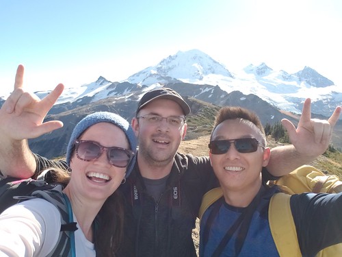
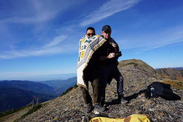
We’ve been dying for the land border to open back up so we can do more fall hiking in the Mount Baker area, but until then, I’ve been reminiscing about the gorgeous weekend in late October 2018 when Lien and Kevin decided to do the Skyline Divide trail. I had no intentions of going with them because a friend had just visited and we’d spent Friday night partying followed by a full day exploring Whistler on Saturday, so I was pretty tired. But at the last minute I decided I didn’t want to miss out and joined Lien and Kevin bright and early to drive down towards Baker. So glad I did because I had the best time on this hike!
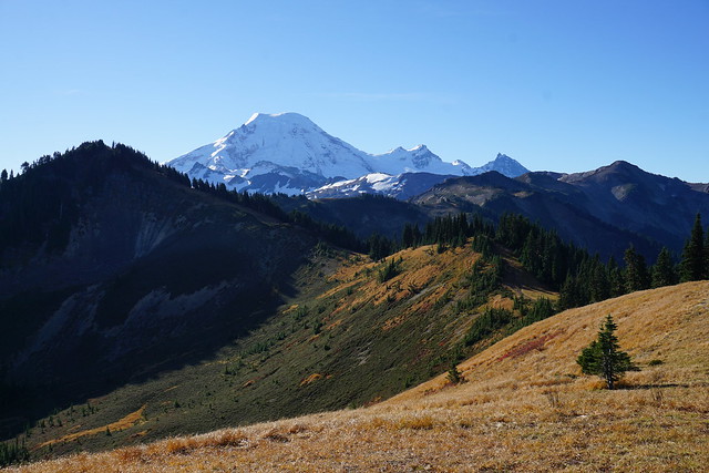
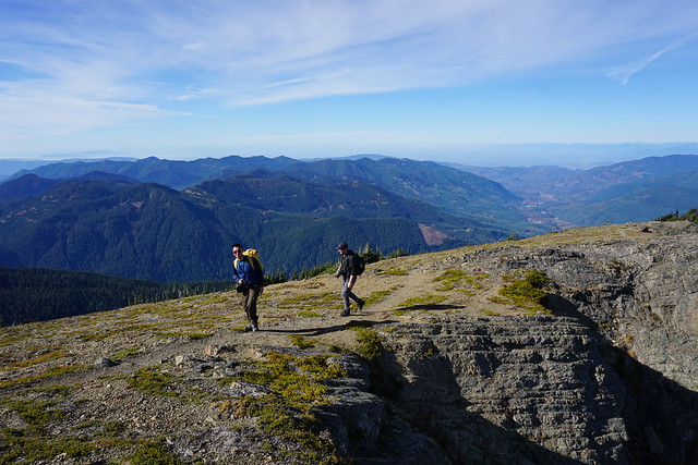
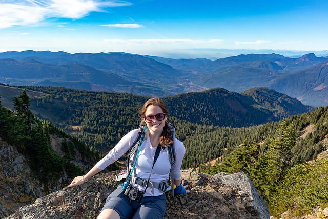
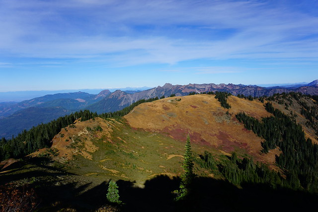
Like most hikes, Skyline Divide starts with a steep-ish climb up through the forest to get to the ridgeline. It’s about 4km to the top and then from there, it’s scenic “skyline” views the whole hike! I was in awe of the view when we first hit the top and something about this trail just makes you want to keep propelling forward. There’s a small side trail to a viewpoint right when you reach the ridge and then there’s a fairly steep section as you continue along the trail. From there the trail undulates up and now from peak to peak – it’s a workout, but the views are incredible, I truly loved every second! I love trails that hike along the ridgeline because they are truly epic, but generally you have to hike quite a distance up in order to get to those kinds of trails, making them better for backpacking. Skyline makes for a great day hike!
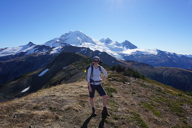
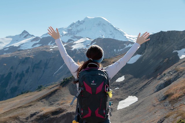
I’m not sure where the official end to the skyline trail is, but it keeps going from peak to peak and at some point we passed the end and just kept on going. Poor Kevin was struggling with all the uphill sections. Every time we crested a hill me and Lien would be like, “Oh wow, this is amazing, but look there’s another peak after this one, we have to go there!” We kept saying “Last one Kevin, we promise!”, but we were lying every time. There was always another peak that we wanted to push on to and I don’t think Kevin had the energy to say no to such gorgeous views. I think our energy and excitement was mostly propelled by the fact that the entire time you are hiking towards Mount Baker. So after every peak you think that if you push just one peak further, you’ll get an even better view. This was my first hike in such close proximity to Mount Baker and I’ve since learned that Baker is extremely misleading in sheer size. It’s so large in comparison to all the other surrounding mountains, that it tricks you into thinking it’s much closer than it actually is.
In any case, we continued to push forward until the trail started to look less like a trail and more like a climb. Then we finally stopped for lunch and continued soaking in the views. It was late in October when we did this hike, so in retrospect I’m impressed we were able to push as far as we did as we would have had limited daylight hours, so we must have been making a pretty good pace. It was also surprising how warm it was – I’d worn my zip off pants and ended up taking off the pant legs and just hiking in shorts. But I do remember it being a particularly warm Fall that year, so that’s definitely not normal. In contrast, we did another hike in the same area (Yellow Aster Butte) last year in late September and I wore my winter coat and there was snow at the top, so the conditions vary from year to year. Just because we were able to hike Skyline in late October that year doesn’t mean it would still be accessible at the same time in the future.
After lunch there was nothing to do but push back, climbing every peak in reverse. I didn’t notice that much traffic on the trail in, but I guess we’d had a head start on a lot of people because we definitely encountered a lot more hikers on the way out. Even late in the afternoon some were just cresting the ridgeline, I suspect their ultimate goal may have been to catch the sunset, which would have been lovely, but we still had to drive back to Vancouver, so we started the trek back down to the car. The forested section is definitely not as fun coming down. It’s quite steep, which I find hard on the knees and poor Kevin was dying. It’s not my proudest moment, but I really just wanted to pound down the last section to get back to the car to rest my knees, so I left the boys behind and ended up waiting for them at the car.
According to my hiking book, Skyline Divide is officially 13km long with 670m in elevation gain, but I tracked 16.5km and 830m elevation gain on the hike we did, so not too much farther than the official trail, I think perhaps 2 peaks beyond. In conclusion, I would 100% recommend this trail. It’s steep at the beginning, but overall not a challenging hike and it has the most rewarding views! Very sad we haven’t been able to go down to the North Cascades this year, but looking forward to more hikes in the future.
Pingback: Hiking Yellow Aster Butte | The Road Goes Ever On
Pingback: Hiking Winchester Mountain | The Road Goes Ever On