Ottomite Peak Snow Camp

I didn’t do much hiking in the Fall last year, but as soon as winter hit I’ve been out exploring in full force! I only did one snow camp last year and was really keen to try and fit 2 in this year. It’s always a challenge because I like to ski a lot too and the snow season is so short.

Fortunately, the weather aligned for us to make a trip out to the Coquihalla in early February. After a very snowy December, it’s been a pretty warm start to the year and all the local mountains were above zero degrees. The Coquihalla can get cold, but it reliably has snow, so it’s one of my favourite places to go in the winter. To date, we’ve been to Falls Lake and Zoa Peak.

PSX_20230205_201133

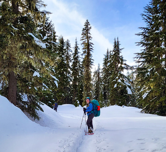
It rained most of our drive up the Coquihalla, but it switched to snow just before we got to the Summit Rec Area, which was very lucky. I’d never even heard of Ottomite Peak, but Carolyn came across it somewhere and it’s a pretty low risk trail, so we decided to check it out. You park in the lot at the base of Yak Peak (across the road from the Needle Peak parking lot) where there is a really nice rest stop bathroom. The trail starts around the edge of the bathroom and runs slightly parallel the highway as you ascend up towards the peak.

20230204_135419

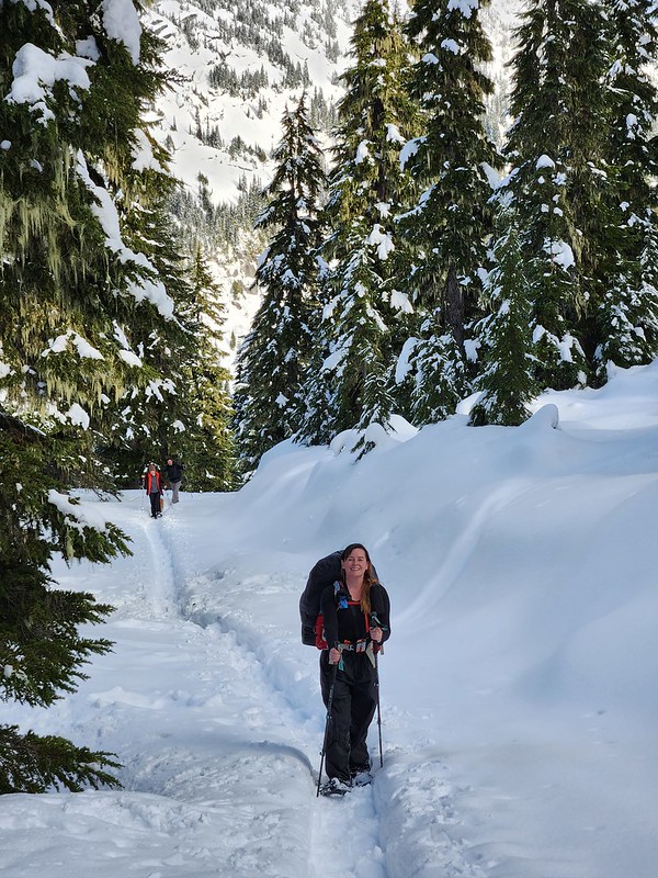
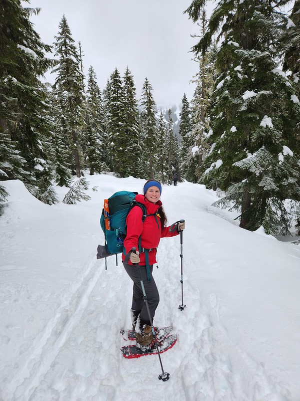
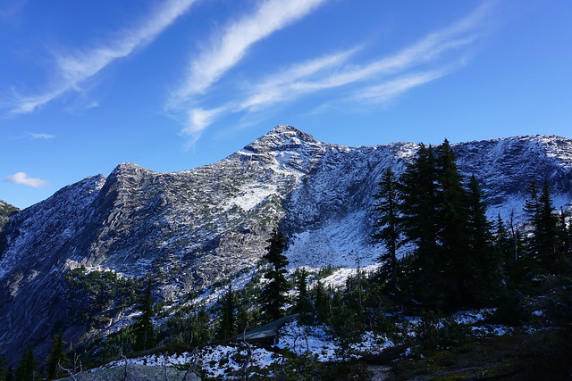
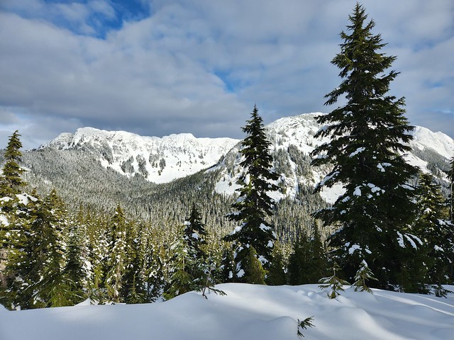
I tracked just over 4km from the parking lot to Ottomite Peak. The trail is mostly in the trees and is all simple avalanche terrain until Ottomite. It’s also popular for ski touring and most of the skiers were continuing past Ottomite to Iago Peak. We considered it, but the trails goes into challenging terrain near Iago Peak and the avalanche risk was considerable in the alpine at the time, so we opted not to. There was a beaten track until the branch to Ottomite Peak, which has a really beautiful view and would also be great for camping.

20230204_142234

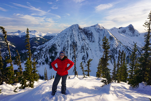
The trail continued on towards Iago, but we had to break the trail to Ottomite Peak. It’s pretty rare to have to break trail in Southwest BC, the only other time I’ve done it was when we snow camped at Poland Lake last winter. It’s a lot more work, but fortunately it’s not too far to the peak of Ottomite Peak. Overall it took us about 2 hours from bottom to top. There’s a great view of the north mountains from Ottomite Peak, so we decided to camp at the top.

20230204_145933

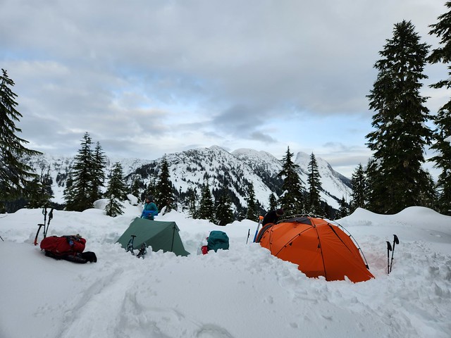
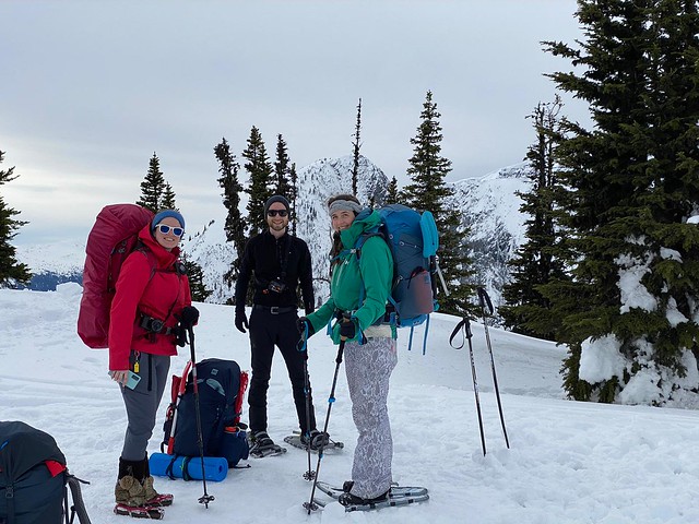
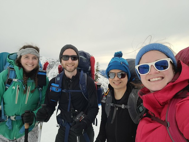
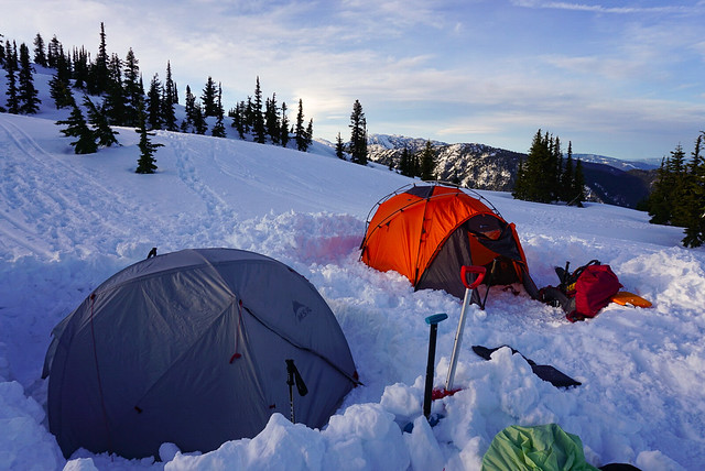
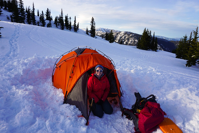
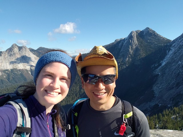
As usual, there were 4 of us on the trip, but Steve couldn’t make it, so our friend Marie accompanied Carolyn instead! Brandon and I shared his big 4 season orange tent as usual, and Carolyn experimented with her summer tent. She typically uses her 3 season MSR Elixir, but she has a non-freestanding 2p Durston tent that she wanted to try out. It took her a while to get it set up properly as it’s a bit tricky since it relies on using your hiking poles and tension to stand. But she managed to get a good pitch and said it worked fine for the night.

20230204_154708

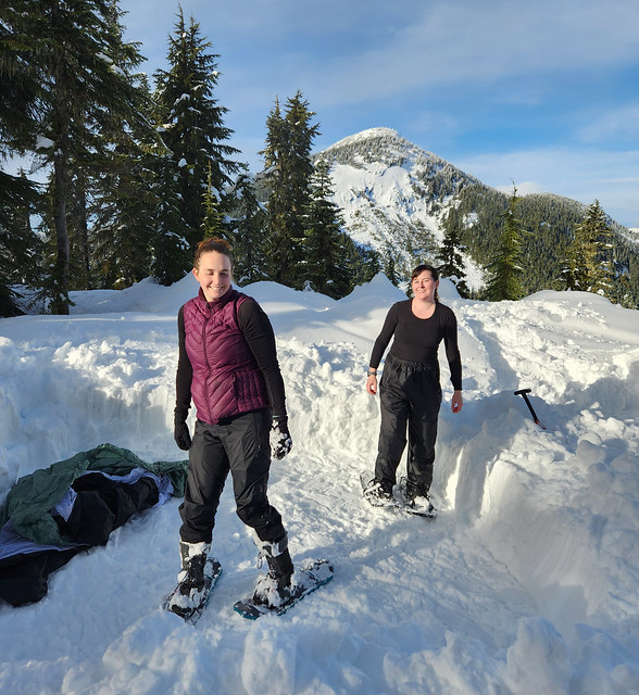
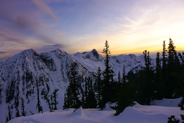
The weather was surprisingly nice on Saturday. We were expecting it to be overcast and snowy, but it cleared up a lot while we were hiking in and we actually got some blue sky and sun while we were setting up. Eventually the clouds moved back it, but we got some really lovely views from the peak, which we easily could have missed.

20230204_172103

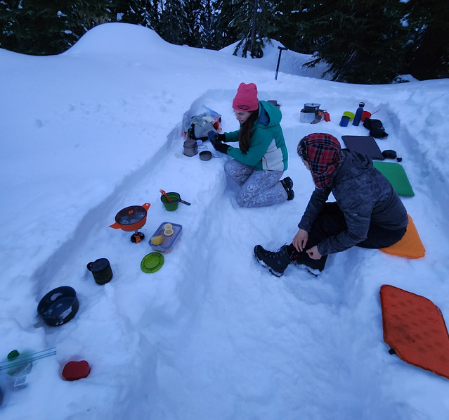
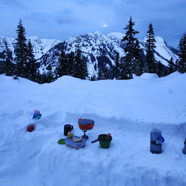
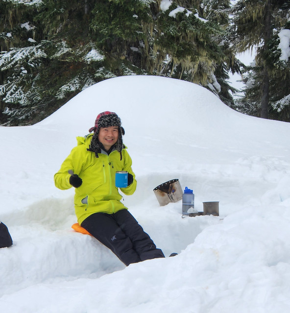
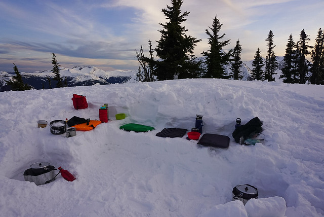
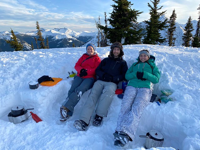
We built a nice big snow kitchen where we hung out for the better part of 4 hours while melting snow and preparing supper. Marie made hot lemon whisky and I made Kahlua hot chocolate bombs for happy hour and Brandon made our favourite thai chicken curry for supper. Then we had Marie’s apple crumble for dessert, so it was quite a spread! If you think me and Carolyn got off easy, I made lunch sandwiches and she made us homemade egg mcmuffins for breakfast!

20230204_172312

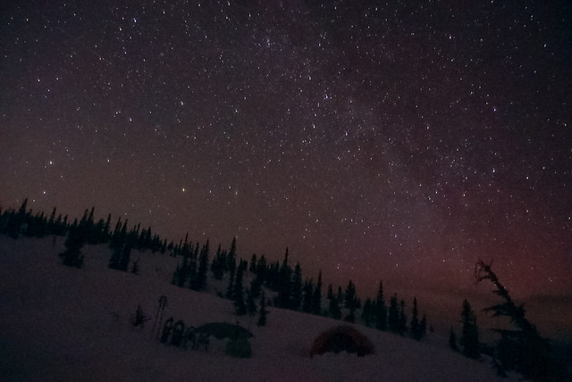
The temperature was really hovering around zero, so it was one of our warmer snow camps and we were lucky it didn’t rain to be honest. We stayed up until around 8:30pm, which is pretty late for snow camping, before hitting the sack for a long night’s sleep. I slept pretty good early in the night, but then I was treated to the symphony of Brandon’s snores later in the night. The moon came up overnight and I enjoyed a beautiful view when I got up to pee, with the moonlight reflecting off the snow, it was super bright and I didn’t even need my headlamp.

20230205_092132

Otherwise it was a low key morning and we packed up our gear and headed back to the parking lot. It was a lot faster hiking out and we stopped in Hope on the way back for the Blue Moose CafĂ©. Considering how little known this trail is – I really liked it! It is in avalanche terrain, but it’s pretty low risk terrain, so I think it’s good for beginners. I’d definitely like to go back some day and go all the way to Iago Peak, or maybe revisit in the summer, when you can hike several peaks back into the wilderness! Overall, another successful trip!
20230205_111557

Zoa Peak Snow Camping

It hasn’t been the best year for winter activities. Between the pandemic restrictions and the avalanche ratings, it’s been hard to get out and enjoy the snow. We went snow camping at Lightning Lakes in late January and we’ve been trying to fit in a second trip ever since. The avalanche ratings have been pretty consistently at ‘Considerable’ and ‘High’ throughout the last month and we ended up cancelling our trip twice. But we finally got decent conditions this past weekend and decided to go for it as one last snow activity to close out the season.

IMG-20210315-WA0007

Zoa is popular among backcountry skiers because it’s a relatively easy hike up an old forestry road and thanks to the low incline, most of the hike is in simple terrain. Interestingly, the first time Carolyn and I ever snow camped was at the base of the Zoa Peak trail. We’d intended to go to Manning, but a wrong turn on the highway landed us in the Coquihalla Rec Area and we decided to snowshoe 1km in to the Zoa Peak/Falls Lake trailhead and camp on the summer parking lot (which isn’t plowed in the winter). So we felt like we’d come full circle by returning to this area and hiking up to Zoa.

20210314_110814

It was a busy day on the trail with both skiers and snowshoers, but we were the only ones staying overnight and the crowds quickly thinned out when we reached the top. However, it was a very challenging hike up the mountain. Because it was mid-March, it wasn’t really ideal snow conditions for any kind of activity. We debated for ages whether we should wear snowshoes or spikes and ended up with me and Brandon hiking in spikes and Carolyn and Steve in snowshoes. There was really no right answer, but in retrospect, I think snowshoes were overall the better choice.

PSX_20210314_180305

The first kilometre along the access road was very well packed and I had no problem in spikes, but once we started climbing up the old forestry road, snowshoes were preferable. It was really sunny, so the snow became a bit slushy and while we weren’t punching through the snow with spikes, it was a bit like walking on sand and made for a very draining hike up. Most of the elevation gain is done on the forestry road and with the sun beating down on us and reflecting off the snow, it ate up a lot of our energy. We all wore sunscreen on our faces, but I ended up getting burned on the underside of my chin from the reflection off the snow!

PSX_20210314_215122

After about 2.5km, you need to exit the road and hike into the woods. The summer trail exits the road earlier, but in the winter it’s better to continue further up since the grade is lower there. There is some pink flagging tape to mark the turn-off, but it’s easy to miss so I recommend being on the lookout and using a GPS. From there you hike up through the woods until you reach the ridge. It’s still steep, but the trail is more packed through the trees, so my spikes worked better here. It can be a bit confusing because the skiers take all kinds of different paths down through the trees, but as long as you keep going up, you really can’t go wrong and will eventually reach the ridge.

PSX_20210314_180622

Snowshoeing along the ridge up to the sub-peak is gorgeous! I did part of Zoa in the fall once, but it’s much more scenic in the winter because the snow lifts you up higher among the trees, resulting in a better view and not confining you to a single area. In the summer, the brush makes it impossible to travel along the entire ridge and the trees limit a lot of the view, so I much preferred the winter views.

In total, it’s about 5km from the highway to Zoa Peak. We decided from the beginning that we would cut off a kilometre and only hike as far as the sub-peak. This is because after the sub-peak the trail gets steeper and the avalanche terrain changes from ‘simple’ to ‘challenging’. The avalanche risk on the day we went was ‘moderate’ in the treeline and ‘considerable’ in the alpine. Zoa seems to be kind of on the cusp between treeline and alpine, so we decided to play it safe and camp at the sub-peak.

PSX_20210314_181717

By the time we reached the ridgeline, we were all exhausted, so we decided to camp just below the sub-peak. It was calling for a bit of wind overnight and we wanted to be sheltered, plus the views are gorgeous all along the ridge. So we found a good looking spot and got right to work on setting up camp. Unfortunately, stopping triggered a few issues for me and after a few minutes of shoveling I found myself getting really lightheaded. I think I was dehydrated, so I took a break and tried to re-hydrate with some electrolytes. We all suffered some mild dehydration throughout the hike, so it was a good reminder to drink lots of water prior to a hike as well. Fortunately we had lots of electrolytes and were all able to recover.

IMG-20210315-WA0003

So Brandon did a lot of the shoveling for our set up and eventually I got to work on a snow kitchen. The snow was really sticky so it was good for setting up a kitchen and we didn’t have to pack it down too much. There were 4 of us, so Brandon and I shared one tent and Carolyn and Steve shared another. We had a great view of what I think was Thar, Nak, and the back of Yak Peak and enjoyed hanging out watching the mountains. One of the benefits of going so late in the season was that we had a bit more daylight in which to enjoy the view.

Brandon made us miso soup to help with rehydrating and then we all got to work on melting snow for dinner. I shared Brandon’s classic thai curry chicken, which is my absolute favourite backcountry meal! My parents had sent me some chocolate from Newfoundland Chocolate Company, which we enjoyed as a treat for dessert.

DSC08805

Usually when we go snow camping, we go to bed super early because it gets so cold and dark, but it was a warmer evening and the clouds had completely cleared out, leaving a beautiful view of the stars! So we stayed up much later than we usually do and I took star photos while Steve messed around with his radio to get us some tunes. Two night hikers passed us right after it got dark, but otherwise we were the only ones around and enjoyed a beautiful sunset. It ended up being 9:45pm by the time I finally crawled into the tent for bed, which is by far the latest I’ve ever stayed up snow camping!

PSX_20210314_215927

I didn’t get the best night’s sleep as the wind picked up overnight and shook us around a bit. Nothing to be concerned about, but it did make it a little harder to sleep. I made an egg and bacon hash for breakfast and then Brandon and I hiked the last few metres up to the sub-peak to check out the view. Otherwise we just took down camp and packed up again to head home. It was a lot easier on the second day because the sun stayed behind the clouds, meaning the slush had become more solid and was easier to hike out in spikes. We didn’t see as much traffic and powered down the trail in just an hour and a half (versus the 3 hours it took us to hike up).

So overall it was definitely one of the more challenging hikes, but the weather and views from the top were amazing and we ended up having a great time!

PSX_20210314_173321

Hiking Flatiron

For mine and Brandon’s third annual Thanksgiving weekend hike, we did Flatiron for the first time in 2018. Now while I think Elfin Lakes and Watersprite were a bit of a stretch to be considered “Fall hikes”, I thought that Flatiron was a great Fall hike, but not in the traditional sense.

20181006_113929

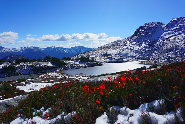
We’d intended to do the Needle Peak trail, which shares the same trailhead as Flatiron, but once we got up to the branch and saw the layer of snow sitting atop this steep climb, we decided to leave it for another day and do the Flatiron trail instead. Flatiron continues on past the Needle Peak branch and hikes down through a pass and back up again to a small glacial lake. I’ve since learned this a popular location for camping in the summer, but in October it was pretty empty.

DSC07390

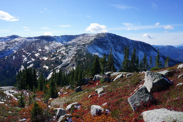
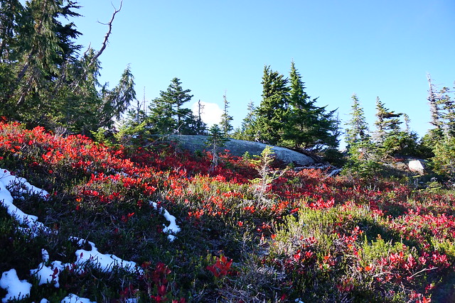
The lake is what I think makes this a great non-traditional Fall hike. The trail continues over a steep slope to the top, which is a giant flat plateau (hence the name Flatiron). At just the right time of year, all the shrubbery against the slope turns this beautiful shade of deep red. Pair it with a fresh coat of snow, which is how it looked when we visited, and it really gives you lots of changing season vibes. I think your timing probably does have to be just right, but even if you missed it, it’s still a great hike.

DSC07371

There were very people on the trail when we visited and most of them seemed to be attempting Needle Peak. There were just two other guys going the same way as us. We passed them on the way up because they had big backpacks on. We asked if they were planning to camp and they informed us they were actually hoping to fly down!

This was my first experience with paragliding and I have to say it’s a hard pass from me. Even Brandon, who is much more adventurous than me said you’d never get him paragliding. We were pretty much the only two groups on top of the Flatiron, so we watched them setting up their flight suits as we ate our lunch. I admit we definitely lingered over our lunch because we really wanted to watch them fly off.

DSC07386

From the start, it was clear one guy was more experienced than the other and they chatted a lot as they got set up. Eventually, after much checking, they finally got ready to take a run. The more experienced guy had no problem and the wind caught him and took him right off the side and up. We watched as he sailed off and circled up and up in the wind currents for about 20 minutes before finally landing back at the car park.

DSC07360

Unfortunately the second guy didn’t have quite as much luck. He took off just after the first guy, but he terrified me and Brandon with a fall right at the start. It almost looked like he was going to get up, but the wind took his chute funny and he ended up crashing to the ground. It wasn’t a far fall, but it didn’t look comfy and it made us really nervous to watch him. I can see why Flatiron is a great place to practice though, there’s lot of wide open space in which to run from and relative safety from which to fall until you head out over the edge.

DSC07376

We watched him make 2 more unsuccessful attempts and then Brandon decided it was time to get out of there or we were going to be watching this guy fall to his death. After that he decided to give up and ended up packing up and hiking back down to meet his friend at the car. So fortunately no one was injured, though I’m sure he was disappointed.

DSC07391

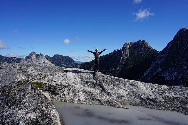
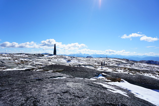
As usual, it was freezing at the top of the trail for October, but this time we’d come prepared with warm jackets so that we could stay out and watch the view. Unlike our other two trips though, this year we got clear blue skies and lots of sun, so it made for an incredibly scenic trip! It’s a steep trail, with 800m of elevation gain spread over 11km round trip, but so worth it for the 360 degree views at the top!

If you’d like to hear more about Flatiron or see more photos, I have published another blog post on an overnight trip I took in July 2020.