This is a cautionary tale.
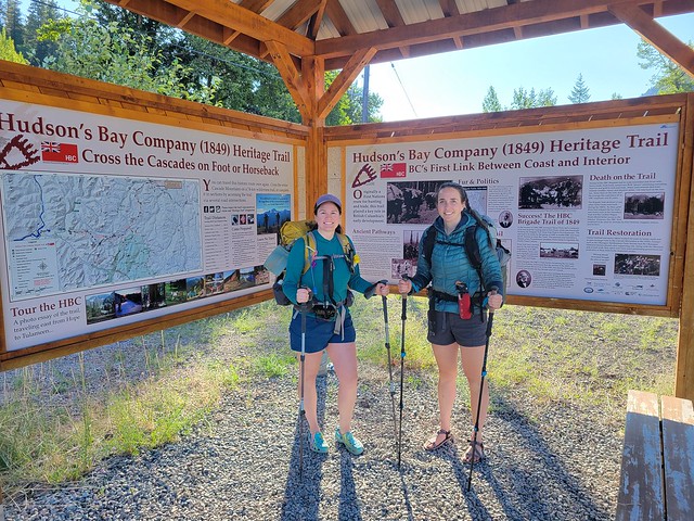
Let’s get that little bit of foreshadowing out of the way and talk about the Hudson’s Bay Company Heritage Trail. It’s a little known trail that traverses through the rugged wilderness north of Manning Park, between Hope and Tulameen. The trail is a remnant from the fur-trading era and was used by both First Nations and settlers alike. The trail is 74km long and traverses mostly through mountain forest, with a few passes through the sub-alpine.
I make it a bit of a hobby to spend lots of time studying maps, which means I have a long list of trails that I want to complete, including the HBC Trail. While I’m hyper organized about my trail selection, Carolyn has a more chaotic energy and appears to just stumble upon trails and become fixated on it until she completes it. I’m not sure where she heard about the HBC Trail (quite possibly it was from me), but she decided she really wanted to do it this year. This got me hyped up to do it as well and I made a few bad choices in my excitement.
I did a lot of kayaking this Spring and then I went home to Newfoundland for 2 weeks at the end of June, so all of a sudden I found myself in the middle of July and I had yet to do a single backpacking trip. In contrast, Carolyn solo hiked the West Coast Trail and the Juan de Fuca Trail back to back in late June (along with several other trips throughout the month), so she was in peak condition. We only had 3 days in which to do the trail, so I was on the fence about whether or not it was a good idea. 74km in 3 days is a lot of kms per day, and while I did hike that much when I did the Sunshine Coast Trail last year, that was at the end of my backpacking season as opposed to the start. In any case, I figured I’d just suffer through a few long days and then move on to other trails. Poor judgement on my part, but here we are.
So we decided to go for it! But we couldn’t have done it without the help of my generous husband. After work on a Friday in July, we drove my car and Carolyn’s car out to Hope. We left Carolyn’s car in Hope and then Seth proceeded to drive me and Carolyn (and our 2 dogs) all the way to Tulameen for the night. We all camped at Otter Lake and then Seth dropped us off at the trailhead in Tulameen at 7am on Saturday morning. So he basically drove us 4 hours out to Tulameen, just to drive all the way back alone with 2 dogs. He’s a keeper!
There’s a few more things you should know about the HBC Trail before I continue. Like I said, it’s a relatively unknown trail. It does have its own trail group on facebook, but it’s not a very popular trail. Most of the trail is in the woods with peek-a-boo views, with the exception of ~5km of trail around Palmer Pond. It’s 74km if you’re thru-hiking it, but there are several 4×4 access roads that are used for hikers doing day hikes or those that just want to do a 1 night backpack. Because of the extensive network of 4×4 trails, there are several rec sites that have pull in frontcountry campsites.
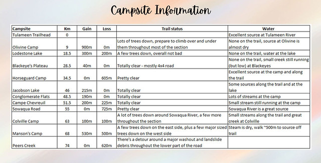
The most noteworthy thing about the trail right now is that it’s not in great condition. The flooding in 2021 did a lot of damage and because of the erosion, there’s a lot of trees knocked down along the trail. Volunteers have been out clearing the trails, so we knew some of the middle sections would be clear, but we knew there were other sections where we would have to contend with a lot of blowdown. Here’s my assessment of the trail sections as of July 24, 2023.
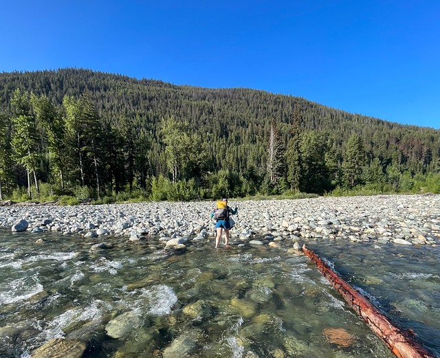
Day 1 was our most ambitious day because we were aiming to go from Tulameen all the way to Blackeye’s Plateau, which is just over 28km and ended up tracking as 30km on my GPS. The trail starts with a river crossing. There are 3 crossings on the trail and the hardest one is Tulameen River. Fortunately for us, it’s been a very dry summer, so we got wet up to our knees, but it was a relatively easy crossing.
Right off the bat we learned that we were going to need to be vigilant with wayfinding on the trail. There’s a big sign showing where to start once you cross the river, but then it’s immediately not obvious where to go. We mostly found the trail by locating the log book, so look for that. As the slower hiker, we opted to have me hike first for most of the trail and be responsible for route finding (looking for signs and markers), while Carolyn would be keeping a close eye on the GPS to keep us on track.
Tulameen to Olivine is particularly confusing because there’s a lot of 4×4 roads running across the trail. You start on the road and we missed the first (and maybe second) turn offs to the trail because we just followed the road without thinking too much. There’s no issue with this if you would like a simpler hike – you won’t have to contend with blowdown and the incline will be more gradual, but be prepared to walk additional distance if you do. When we finally found the trail, we mistakenly went in the wrong direction and ended up back at the road where we’d just been, so we had to undo that mistake and after that we were much more diligent in checking the map.
We both use GaiaGPS for tracking, which served us pretty well, but some of the 4×4 roads are missing from Gaia, so there was definitely an advantage to also carrying a paper map. I had the HBC map, which you can get from the Hope Visitor Centre, and we used it a lot to check on some of the road crossings and water sources, so I definitely recommend getting a copy.
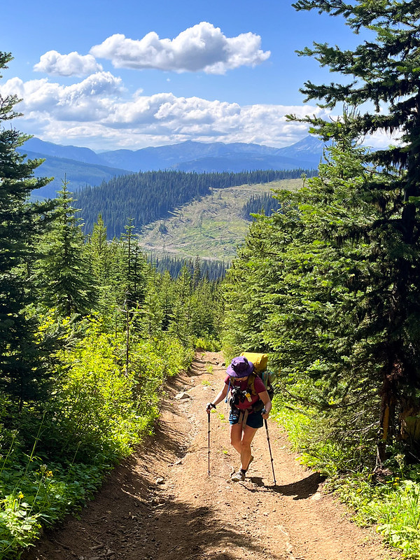
It’s a steady uphill climb to the first campsite at Olivine. I quickly learned that I had not done enough training for this hike and I really struggled on the uphill in the hot sun. It took us about 4 hours to go 9km to Olivine, so that gives you an idea about my pace and after only a few hours I was already severely doubting my ability to do the trail. I toyed with the idea of just doing part of the trail and then hiking back, but Carolyn astutely pointed out that our only vehicle was now in Hope, so I’d better get walking.
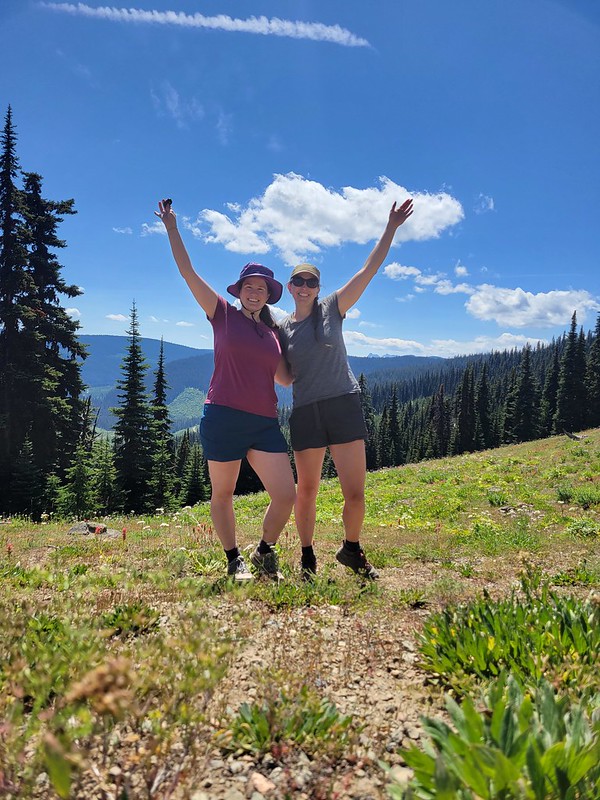
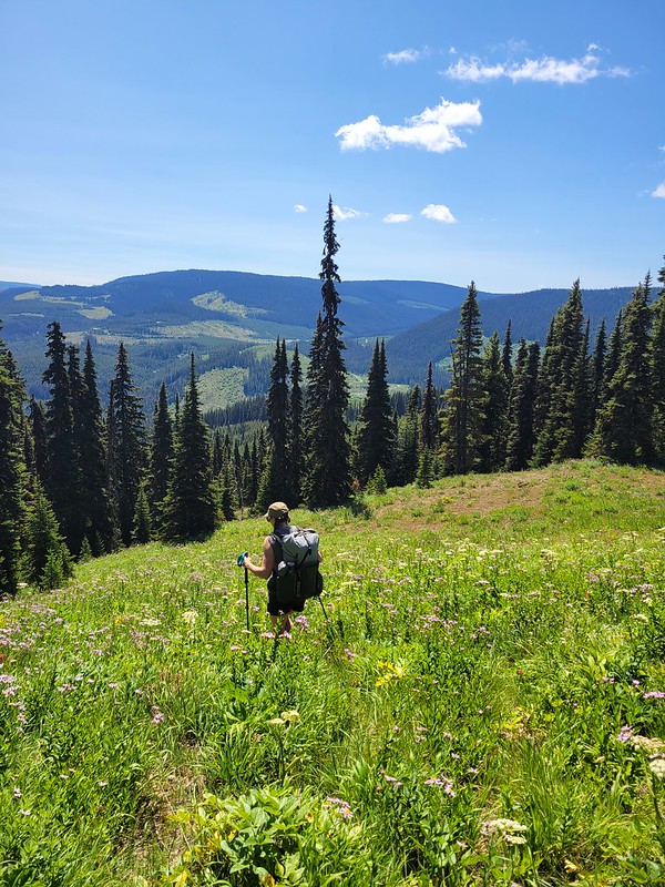
Olivine Camp is lovely. It’s located at the start of the sub-alpine along the ridge and it gave me really strong Manning Park vibes. There were tons of wildflowers in bloom just past the camp and it has a gorgeous view looking out over the ridgeline. In another life I’d love to stay at this campsite. But all we had time for was a visit to the water source to eat our lunch.
To give you an idea of how hot it was, I drank my entire 2L of water in the first section. Unfortunately, the water source at Olivine is 300m off the trail and it was down to the barest of trickles when we arrived. I think it must be a natural spring though, because it was actually a very clean and cold water source, it just took a while to fill our bladders. We enjoyed an hour long break to have lunch before continuing on towards Lodestone Lake.
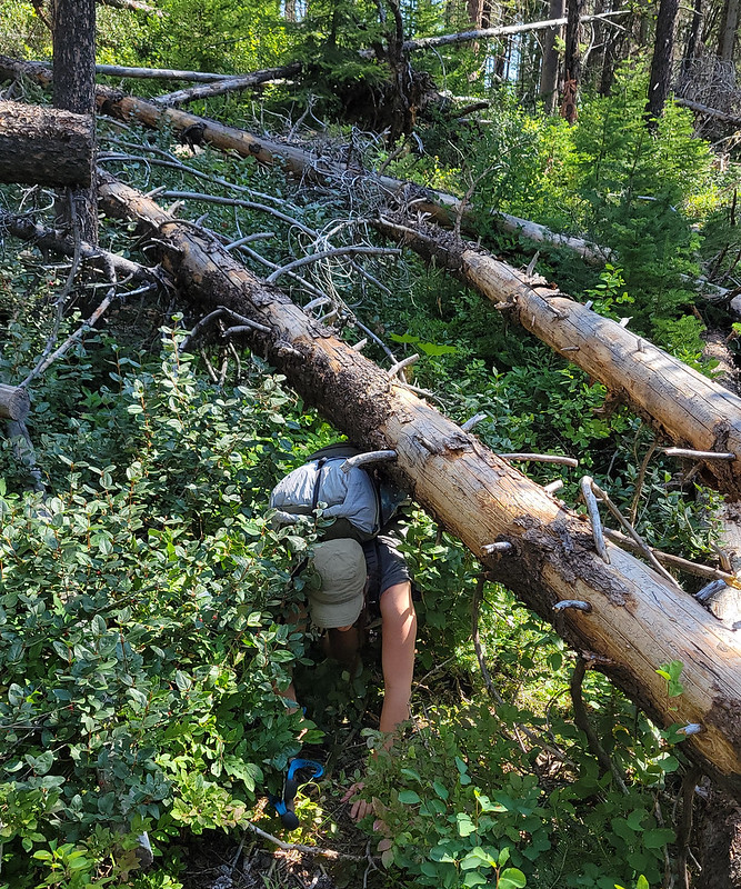
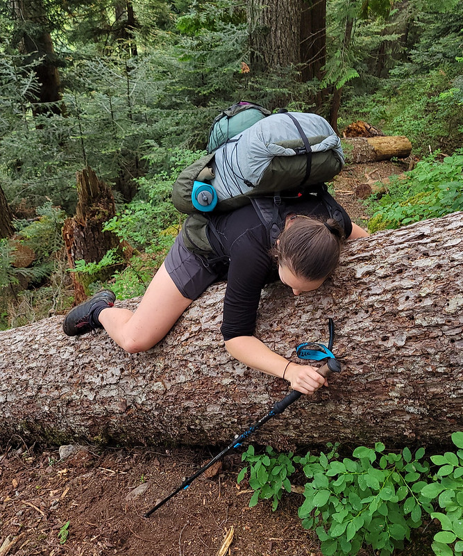
I knew that the trail to Olivine had some of the worst blowdown along the entire trail, and it definitely slowed our pace on the way up. There were a lot of awkward sized trees at awkward heights that we had to crawl under or hop over. I was expecting more of the same going to Lodestone, but fortunately the trail was a lot flatter and there was a lot less blowdown, so we made much better time. In fact, aside from a very bad section around Sowaqua River, the section of trail between Tulameen and Olivine had probably the worst blowdown of the entire trip.
We almost lost the trail again along a logging road, but Carolyn’s funny feelings kept us on course and we were able to do some light bushwhacking to get back on track. The trail is relatively well marked, but it’s really easy to get off it and we relied a lot more on wayfinding with map and GPS than expected. The trail meanders up and down for a while before it starts a descent to the Tulameen FSR. After the FSR, you climb back up to Lodestone Lake, our second milestone for the day.
We had another setback after reaching the road. I was leading when Carolyn remarked “ewww, look at this!” It was a giant, runny pile of poo in the middle of the trail that I had walked through without realizing and now had shit all over my boots. I was trying to wipe it off on some leaves when I looked up to see a truly massive black bear about 5m away in the bushes, staring at me.
We backed up as safely as possible along the trail to the FSR where we made a lot of noise while gripping our bear spray. It was a really big bear – it didn’t seem interested in us, but it also didn’t seem like it was going to move any time soon, so Carolyn studied the map and remarked that there was an easy bypass along the road for that section of trail. So we continued up the road making lots of noise. Just as we rounded the bend to circle back, we saw the bear coming out of the bushes onto the road. Now this made me nervous because it meant the bear had followed our voices, so it was obviously interested in us. Carolyn gripped my arm tightly and started pushing us back down the road as I gripped my bear spray. The beast climbed out of the bushes, drawing itself up to full height…and…
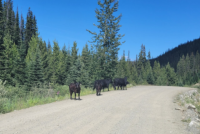
IT WAS A COW.
Our big scary bear was a cow the whole time. I walked through cow dung and then it followed my singing through the woods. As soon as the Bear-Cow came up on the road, it was joined by about 10-15 more of its friends and they all stared at us while we started to laugh. Eventually they lost interest and returned to the woods, so I guess some farmers just let their cows roam wild in the wilderness. It was a bit jarring, but generally we were relieved it was a cow and not a bear.
It was a very slow and hot ascent up to Lodestone Lake Rec Site, but overall our pace increased (even with the bear-cow incident). It took us about 3 hours to do the 9.5km between Olivine and Lodestone and we decided to go for a quick swim in the lake before having supper. Lodestone Lake is accessible by 4×4, so it was an extremely busy campsite and it was the only place on the entire trail where we saw other people. We were the only hikers though, as everyone else had driven there. The lake looks nice, but it’s pretty shallow and muddy, so not our favourite swim on the trail, but very refreshing nonetheless.
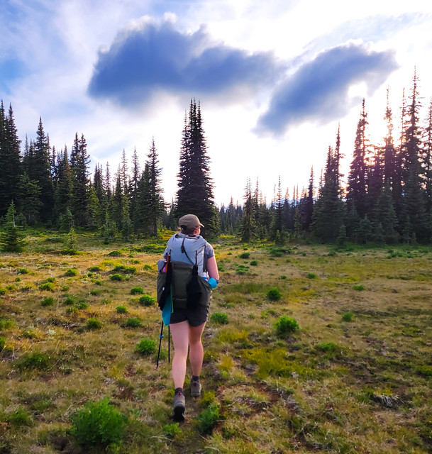
We still had 10km more to go before we were done for the day though, so we tried to be quick leaving Lodestone. I think the only thing that kept me going was that I knew Lodestone to Blackeye’s Plateau was one of the easiest sections of the entire trail. The trail continues along the 4×4 road for 7.5km and it’s entirely flat. So it’s pretty easy walking, but it was also very boring. We passed a lot of off-roaders but didn’t really talk to anyone. Eventually you exit the road and it’s 2.5km of easy walking through meadows to Blackeye’s. By this point I was very much done and ready to crawl into bed.
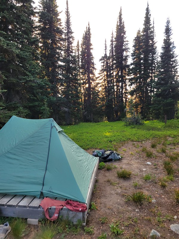
The last section look us ~2.5 hours and we arrived at 7:30pm, meaning that we’d been hiking for almost 12 hours. My feet were tired and I was getting a little bit of chafing on my thighs, but overall I was relieved to have the hardest day behind me. We were very quick putting up the tent and because of the flies, quick going to bed. We hiked 30km, which is the longest I’ve ever hiked in a single day, and I did it on a backpacking trip (my previous record was 29km on a day hike). I was exhausted, but proud of myself. Sadly I didn’t know what trauma was yet to come.
Is the suspense killing you? Come back next week for Part II!
Pingback: HBC Trail Backpacking Trip Part II | The Road Goes Ever On
Pingback: HBC Trail Backpacking Trip Part III | The Road Goes Ever On
Pingback: Hiking Tent Ridge | The Road Goes Ever On